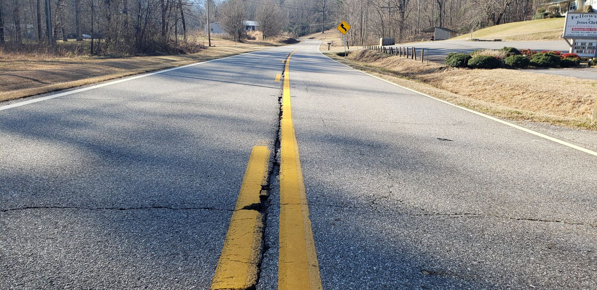
Your fleet already drives every road.
Turn every trip into a survey
RoadScout transforms any fleet vehicle into an AI-powered road inspection platform, producing engineering-grade condition surveys, defect inventories and work-order-ready evidence automatically.
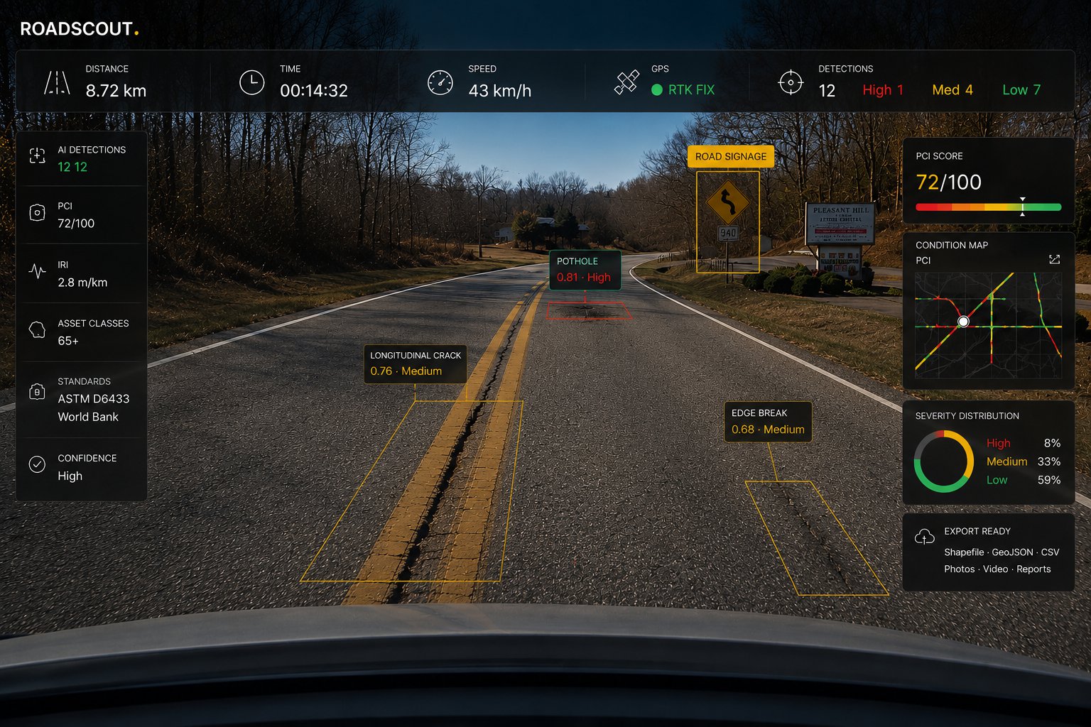
The whole apparatus
The hardware is a phone or our device.
Never a survey truck.
Traditional methods restrict you to one expensive survey a year, and minor defects go unrecorded until they deteriorate into costly repairs. RoadScout captures continuously, whenever your vehicles are on the network. No specialist surveyor, calibration or training required: anyone can collect data.
SEC. 01 / CAPTURE
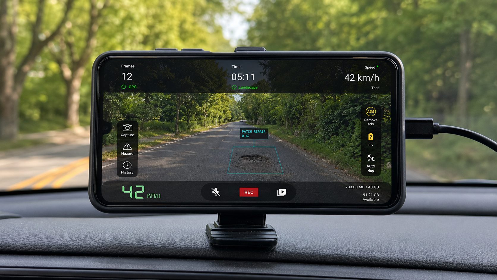 METHOD 01
The RoadScout app: any Android, any vehicle
Install the app, mount the phone on the windshield, drive. Capture runs automatically during normal operations: refuse rounds, inspections, patrols, or dedicated passes. Five-minute setup, no vehicle modifications, no calibration.

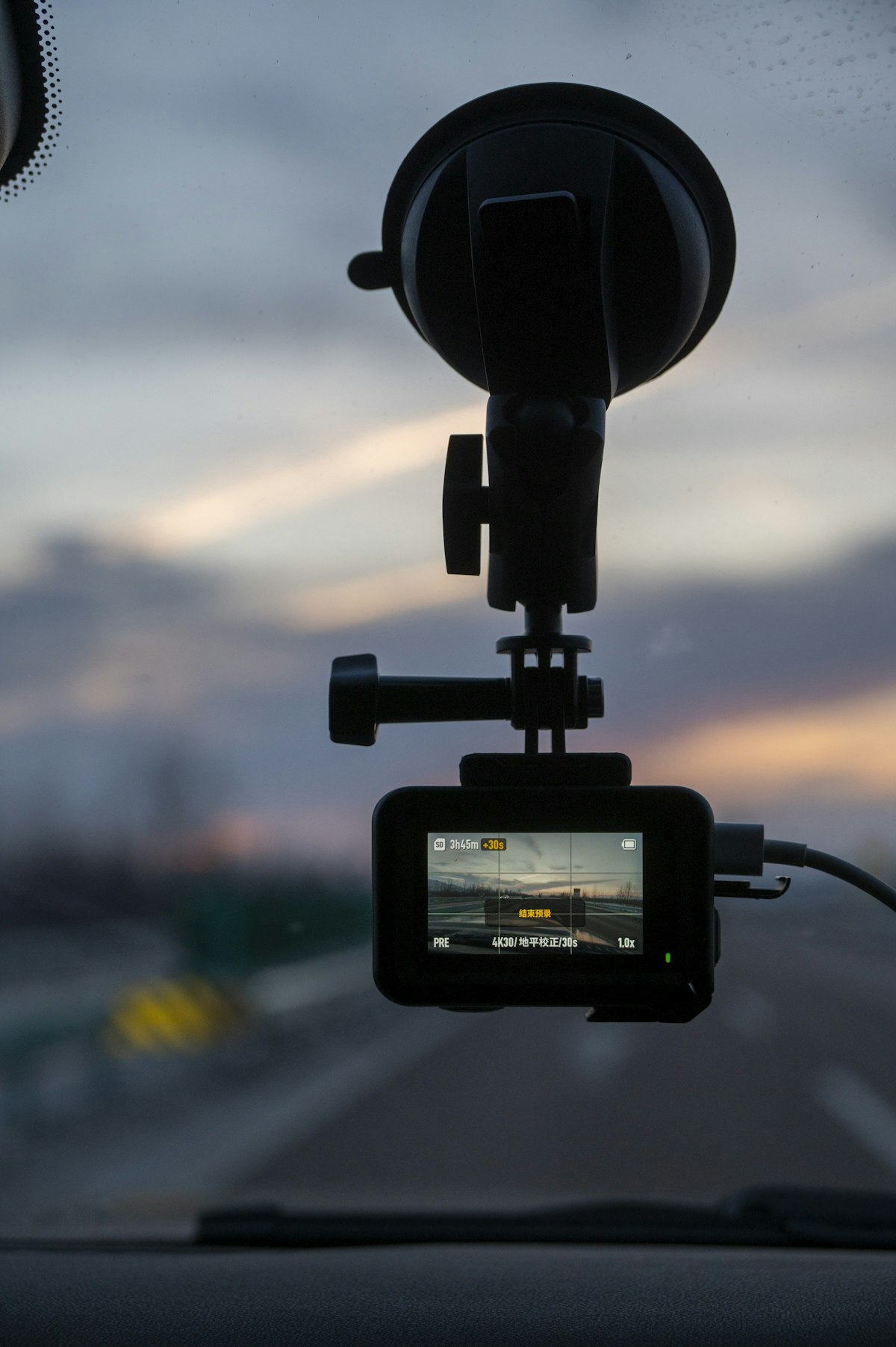 METHOD 02
The RoadScout device: fit it once, survey forever
A permanently installed capture unit for fleets that should never think about it. It powers with the ignition, captures every trip and uploads by itself. No phone to mount, no operator, no missed rounds. Your whole fleet becomes standing survey infrastructure.
Mount & drive
Any Android on any vehicle: refuse trucks, patrol utes, graders. The route you already drive is the survey plan.
Upload happens by itself
Frames and telemetry stream straight to the cloud over presigned uploads. Faces and plates are anonymised automatically for GDPR.
Five models read every frame
Defects, signs, markings, infrastructure and assets, plus corrugation, grade and roughness from motion telemetry. Clustered into reviewable events.
From map to work order
Accept or decline with photo evidence, raise work orders, export to ArcGIS/QGIS, plan budgets on deterioration forecasts.
On your schedule
Road asset management you control.
Replace the annual contractor survey with continuous data collection you run yourself: earlier intervention, better budget allocation, and an evidence trail behind every decision.
SEC. 02 / USE CASES
From reactive repair to early intervention
Surface defects, condition scores and a photographic record in a single pass: a continuously updated picture of network condition, same-day, instead of a weeks-long contractor turnaround. Deterioration forecasts turn it into a multi-year works programme.
Inspect remotely, verify with evidence
Every surveyed route carries a time-stamped visual record. Inspectors review, accept or decline detections from the desk, with photo evidence and GPS fix, cutting repeat site visits and supporting safety audits.
An inventory that updates itself
Signs with 1 to 5 condition rating, line and surface markings, guardrails, street lights, manholes and drains, catalogued automatically on every pass. As your vehicles drive for any purpose, the register stays current at no additional cost.
Prove the road's condition on any date
When a claim lands, point to the record: geo-tagged evidence frames, condition scores, review decisions and work orders. The state of that road on that date, and the actions taken. The same record powers budget requests and funding applications.
Detection coverage
Sixty-five classes. Named, not implied.
Video-AI vendors say "multiple distresses and assets." Here is our actual production class list: five YOLO models trained on 74,000+ images, measured and published.
SEC. 03 / CLASSES
POTHOLE · CRACK/LONGITUDINAL · CRACK/TRANSVERSE · CRACK/ALLIGATOR · CRACK/BLOCK · CRACK/WHEEL-TRACK · RUTTING · RAVELLING (MOD/SEV) · CHIPPING LOSS · SUBSIDENCE · EDGE DETERIORATION · BINDER BLEEDING · DEFECTIVE OVERLAY · PATCH (AREA/SPOT) · SEAL (LONG/TRANS) · SURFACE TREATMENTS ×4
LANE LINE · CENTER LINE · BOUNDARY LINE · STOP LINE · CROSSWALK · ARROWS ×5 · JUNCTION BOX · BICYCLE LANE · BUS LANE, plus MISSING-MARKING detection from telemetry over every 100 m
STOP · GIVE WAY · SPEED LIMITS 10–120 · NO ENTRY · NO OVERTAKING · PEDESTRIAN · CROSSWALK · ROUNDABOUT · TURN LEFT/RIGHT · KEEP LEFT/RIGHT · SIGNAL HEADS (R/Y/G)
GUARDRAIL · STREET LIGHT · UTILITY POLE · BOLLARD · MANHOLE · DRAIN · SPEED BUMP · RUMBLE STRIP · HYDRANT, plus CORRUGATION · GRADE ≥6% · ROUGHNESS→IRI · RIDE QUALITY
Standards, not vibes
Numbers your engineers already trust.
Every 100 m segment is scored on the scales your pavement engineers, auditors and funding applications already use, not a proprietary score you have to take on faith.
FIG. 01 / SCORING
Field evidence
Every detection ships with its proof.
Highway, suburban street or haul road: every clustered event keeps its evidence frames, GPS fix and confidence score, ready for the council meeting or the contractor dispute.
SEC. 05 / PROOF
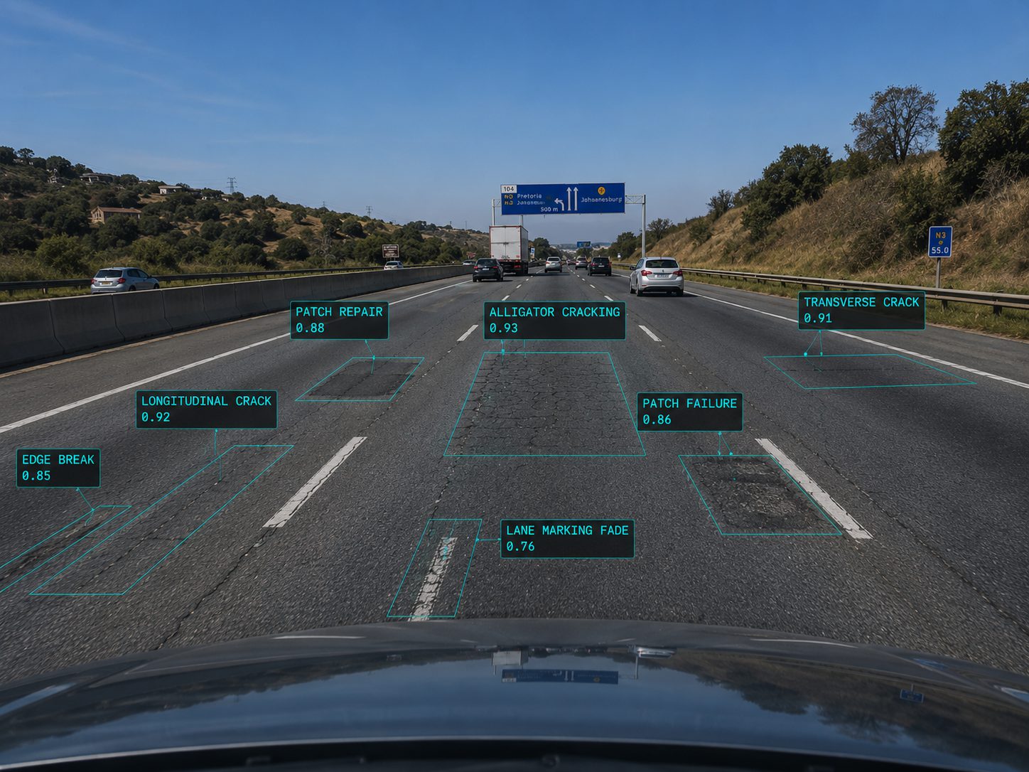 HIGHWAY · N3 CORRIDOR
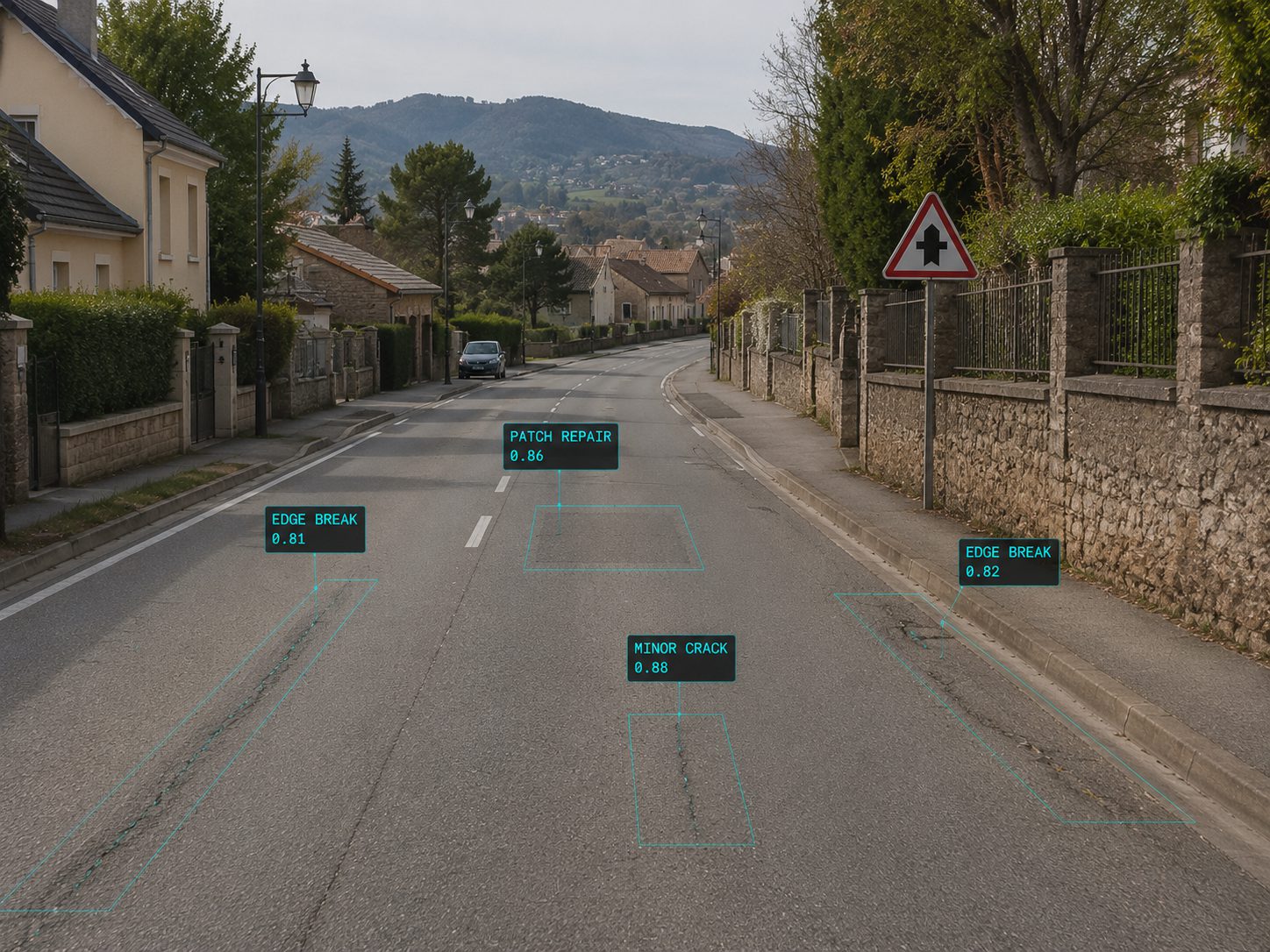 SUBURBAN · RESIDENTIAL
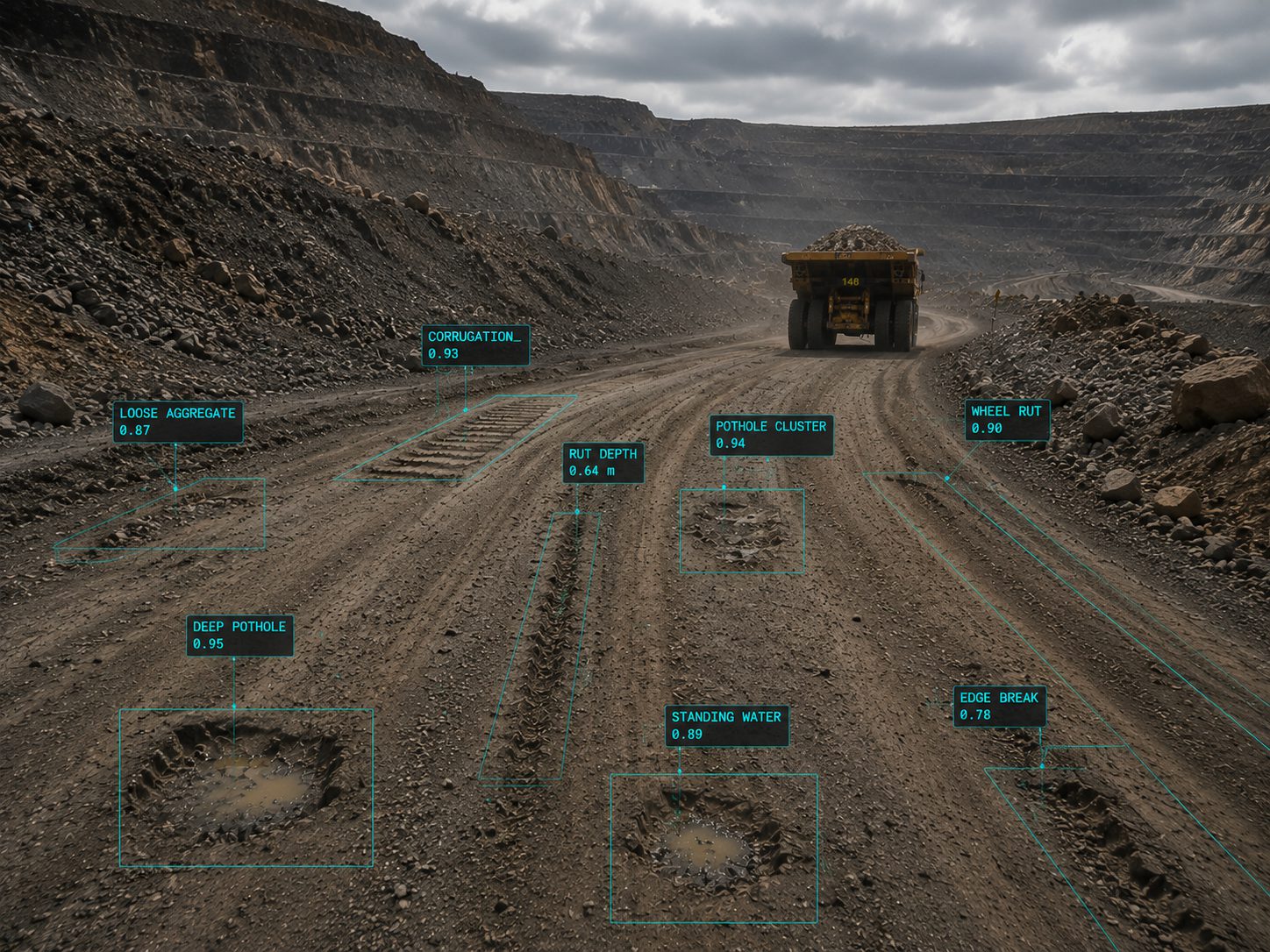 MINING · HAUL ROAD
See your own roads scored by Friday.
One phone, one vehicle, one week of normal rounds: a PCI map of everywhere it drove.