Mount. Drive. Review.
That is the whole method
No survey vehicle, no calibration, no specialist. A phone or the RoadScout device rides along on trips your fleet already makes, and the pipeline turns each one into a scored, reviewable survey in minutes.
Two ways in
Pick your capture method. Or run both.
Both methods produce the same data: frames, GPS, altitude and 25 Hz motion telemetry. The difference is who has to think about it.
SEC. 01 / CAPTURE
 METHOD 01
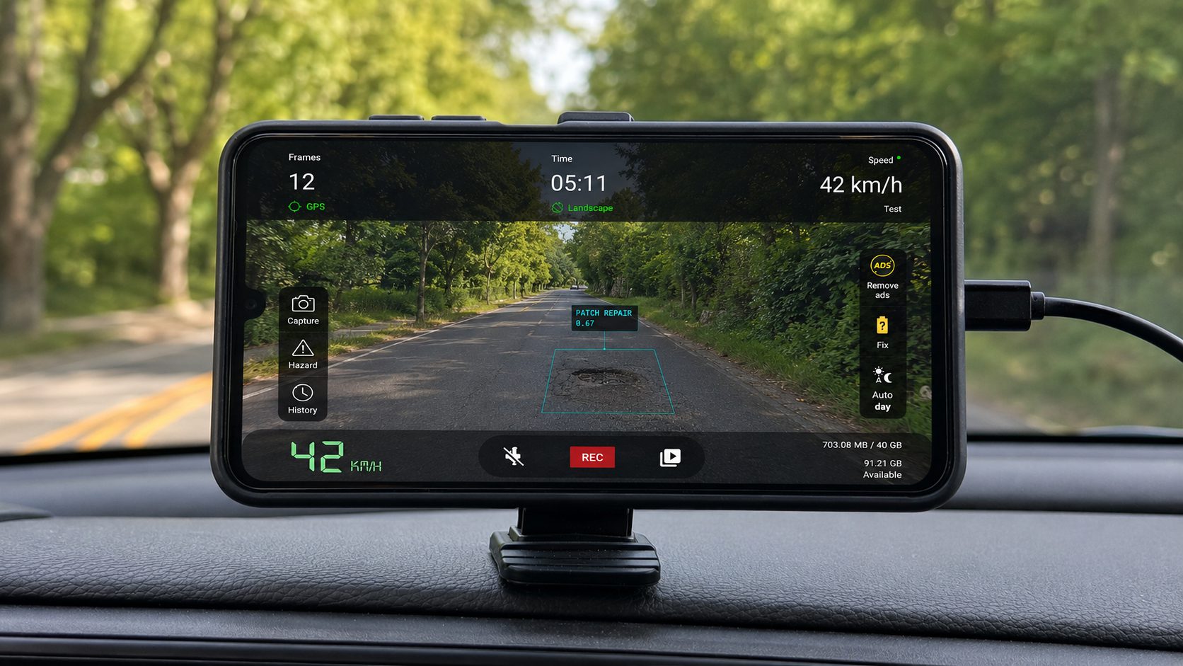
The RoadScout app
5-MINUTE SETUPInstall the app on an Android phone, mount it on the windshield, and drive. Capture runs automatically for the length of the trip. Best for pilots, occasional dedicated passes, and networks where vehicles rotate.
- An Android phone with GPS, camera and accelerometer
- A windshield mount on any vehicle you already run
- An internet connection to upload
- No calibration, no vehicle modification, no training
 METHOD 02
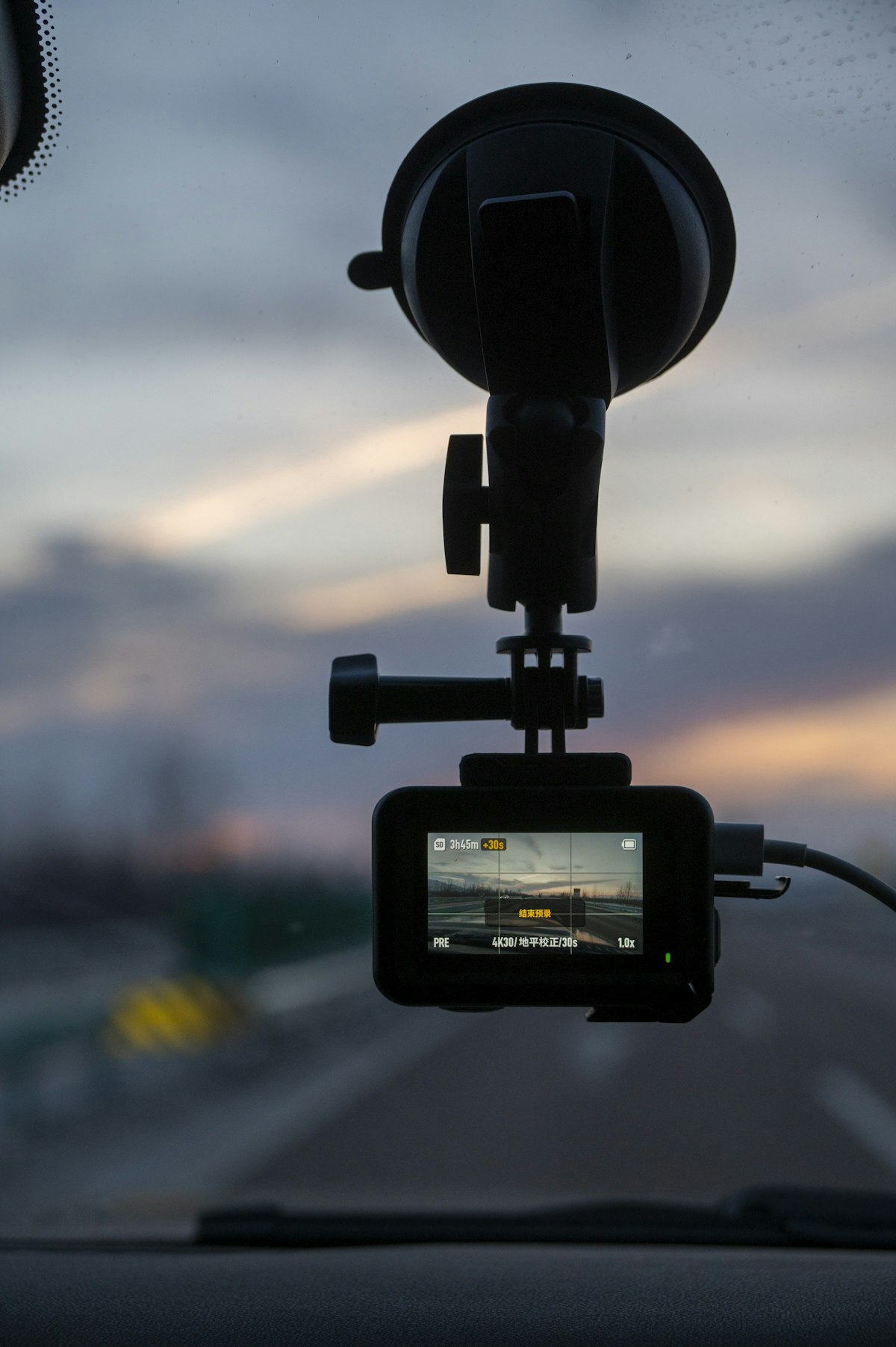
The RoadScout device
FIT ONCEA permanently installed capture unit for fleets that should never think about surveying. Fit it once and your vehicle becomes standing survey infrastructure.
- Powers with the ignition: on when the vehicle is on
- Auto-captures every trip, no operator action ever
- Uploads by itself, no phone to mount, no missed rounds
The pipeline
Four steps from ignition to work order.
Everything between the drive and the dashboard is automatic. Here is what actually happens to the data.
SEC. 02 / PROCESS
Drive the roads you already drive
The app or device captures video frames, GPS position, altitude and 25 Hz accelerometer data while the vehicle runs its normal route: refuse rounds, patrols, inspections, deliveries, or a dedicated pass when you want one. No survey plan is needed, because the route your fleet drives is the survey plan.
Data streams to the cloud by itself
Frames and telemetry upload to AWS over presigned S3 uploads: no footage to offload, no SD cards, no video files to manage. Before anything is stored for analysis, faces and number plates are automatically anonymised for GDPR compliance.
Five models and four analyzers read the trip
Every frame passes through five production YOLO models covering 65+ classes: surface distress, signs with condition rating, markings, infrastructure and common assets. Overlapping detections are merged with cross-model NMS and clustered within a 10 m radius into single events, each keeping its top 3 evidence frames. In parallel, telemetry analyzers extract corrugation, grade, missing lane lines and an IRI roughness estimate.
From dashboard to work order
Results land on the interactive map: accept or decline each event with photo evidence and a full audit trail, raise work orders with priority, assignee and estimated cost, run virtual inspections from the desk, and export to ArcGIS or QGIS. Review decisions also feed human-in-the-loop retraining, so the models keep improving on your network.
The payoff
What lands on the dashboard within 5 minutes.
End the trip, pour a coffee, open the map. This is a representative trip readout: every number below is produced automatically, per trip, per segment.
FIG. 01 / OUTPUT
Standards-based condition scores for every segment driven, plus a 0 to 100 Trip Score
Defects, signs, markings and assets on the map, each with top 3 evidence frames and severity
Corrugation, grades ≥6%, missing lane lines and the roughness-based IRI estimate
Review queue, work orders, inventories, reports and GIS exports, from the same trip
Common questions
The questions every roads team asks first.
SEC. 03 / FAQ
Do we need to calibrate anything?
No. There is no calibration step for the app or the device. Mount, start, drive. Setup for the app takes about five minutes.
Do we need a specialist operator?
No. Anyone who can drive the vehicle can collect data. There is no specialist surveyor, no training course and no vehicle modification.
Does it work on unsealed roads?
Yes. RoadScout classifies nine surface types including gravel, earth and paved-gravel mixed, and the telemetry analyzers were built with corrugated gravel and mine haul roads in mind.
What happens to faces and number plates?
They are anonymised automatically before analysis, as part of the upload pipeline. Capture is GDPR-compliant by design.
How fast are results?
First results reach the dashboard under 5 minutes after the trip ends. No batch queue, no waiting for a processing window.
Which vehicles can carry it?
Any vehicle: refuse trucks, patrol utes, graders, pool cars. The app needs an Android phone on the windshield; the device fits permanently and powers with the ignition.
Run the method on one vehicle this week.
One phone, one week of normal rounds: a scored PCI map of everywhere it drove.